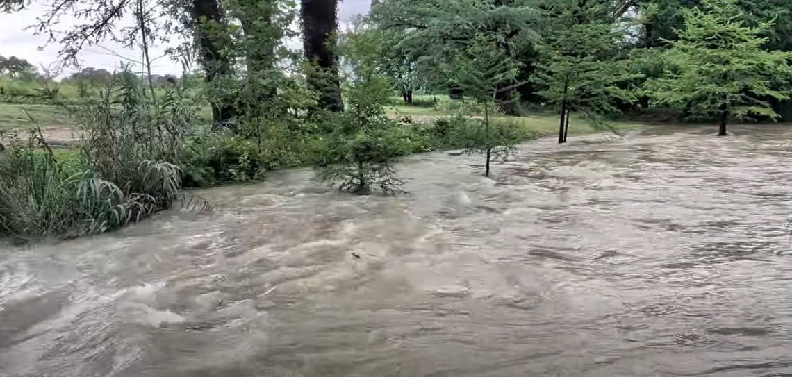
The Medina River at Bandera is forecast to crest at approximately 24.3 feet early Thursday morning, exceeding the National Weather Service's threshold for major flooding, as heavy rainfall continues across the Texas Hill Country and emergency officials urge residents to stay off flooded roadways.
The latest National Weather Service forecast shows the river rising above its 13-foot flood stage Wednesday night before reaching its projected crest early Thursday. While the river is expected to begin falling later Thursday, it will remain elevated into the weekend.
According to the National Weather Service, a river level of 24 feet brings major flooding to the Pioneer RV Park below State Highway 173 in Bandera. Many secondary and primary roads and bridges near the Medina River become flooded and dangerous, and the lowest homes at the upper end of Medina Lake may begin flooding depending on lake levels.
At 25 feet, all campsites at Pioneer RV Park flood and the river comes within about 3 feet of the Highway 173 bridge deck. At 27 feet, the weather service warns of disastrous flooding at Pioneer RV Park, flooding of homes near the upper end of Medina Lake and structural flooding farther downstream in southern Bexar County. At 29 feet, floodwaters are expected to reach the Highway 173 bridge floor, creating life-threatening conditions.
The National Weather Service has extended a Flash Flood Warning until 2 a.m. Thursday for southeastern Bandera County and Kendall County after emergency management officials reported flash flooding in Boerne.
According to the weather service, between 2 and 12 inches of rain have fallen across portions of the warned area, and flash flooding is already occurring. Communities included in the warning include Bandera Falls, Pipe Creek and Lakehills in Bandera County, along with Boerne, Comfort, Bergheim and other portions of Kendall County.
A Flood Watch remains in effect through Thursday evening for Bandera County and much of South Central Texas. Forecasters warned that additional rainfall of 2 to 6 inches is possible, with isolated totals of 10 to 15 inches across portions of the western Hill Country, southern Edwards Plateau and the U.S. 90 corridor west of San Antonio.
The Bandera County Sheriff's Office is also warning residents not to ignore road closure barricades.
"Road closure barricades are in place to protect lives," the sheriff's office said in a public safety advisory. "They are not suggestions or inconveniences—they are there because conditions have been determined to be unsafe."
According to the sheriff's office, driving around a barricade placed because of floodwaters is a Class B misdemeanor under Texas Transportation Code Section 472.022 and is an arrestable offense. Officials said anyone rescued after bypassing a barricade could face criminal charges once they have been safely recovered.
"DO NOT ASK IF YOU CAN CROSS! NO ERRAND, APPOINTMENT, OR TRIP TO THE GROCERY STORE IS WORTH RISKING YOUR LIFE, THE LIVES OF FIRST RESPONDERS, OR FACING ARREST," the sheriff's office said.
The agency urged motorists to obey all road closures and remember the National Weather Service's message: "Turn Around, Don't Drown."
As the flood threat continues, Silver Sage has opened as an emergency shelter for Bandera County residents affected by the severe weather.
According to a Facebook post by Art Crawford, the shelter will remain open overnight and throughout Thursday. Cots have been set up for individuals and families needing a safe place to stay.
Residents needing emergency shelter are encouraged to go to Silver Sage.
"If you need us, we are here," Crawford said in the Facebook post.
Meanwhile, Medina Lake continues to rise rapidly from recent rainfall.
According to the Bandera County River Authority and Groundwater District, the lake stood at 11% of conservation capacity Wednesday, up from 9.3% Tuesday and 4.3% one month ago. The lake's average water elevation reached 995.30 feet, while storage increased to 27,949 acre-feet, more than doubling from 10,923 acre-feet recorded one month earlier.
Officials continue to urge residents to monitor forecasts, avoid flooded roads, obey emergency instructions and seek shelter if needed as additional rounds of rain move across the region.



.png)